
“Hiking” and “Slovenia” were two words I had never thought to put together until I started thumbing through my copy of Walking in the Alps (Lonely Planet). In the midst of finalising our hiking itinerary, we had to make some tough but realistic calls about which hikes were going to fit together best in our short five-week trip. So while hikes in Sweden, Iceland and Norway had to be scrapped (too far away, too expensive), we were able to keep Slovenia in the mix, mostly due to it’s proximity to other hikes we were undertaking in Austria. The appeal of Slovenia lay in the novelty of neither of us having ever visited the country before, or in fact not even having heard of it as a hiking destination. We researched a few possible hikes in the Julian Alps and finally settled on a three-day circuit in Triglav National Park, named after Triglav, the highest mountain in the park and in all of Slovenia (2864 metres).
The three day hike wouldn’t be a “walk in the park” by any means; day one was to involve a 1,900 metre ascent over 15 kilometres. And we set ourselves up to struggle by setting off on the hike tired. Our “rest” day in Bled the day before had been anything but restful: we had walked over 11 kilometres around the beautiful Lake Bled and then to Vintgar Gorge and back. We were just so taken by Bled: it’s friendly, helpful people, it’s picturesque lake, the mosaic of well-tended fields and orchards sandwiched between flower-filled villages, and in the distance, the forested mountains.
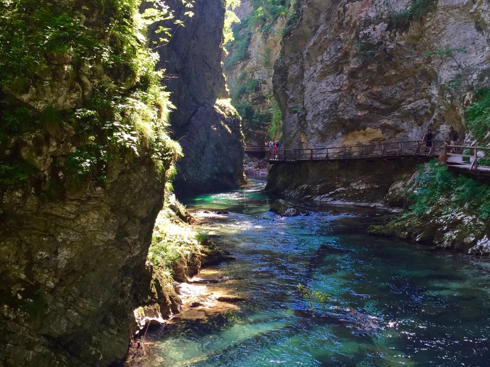
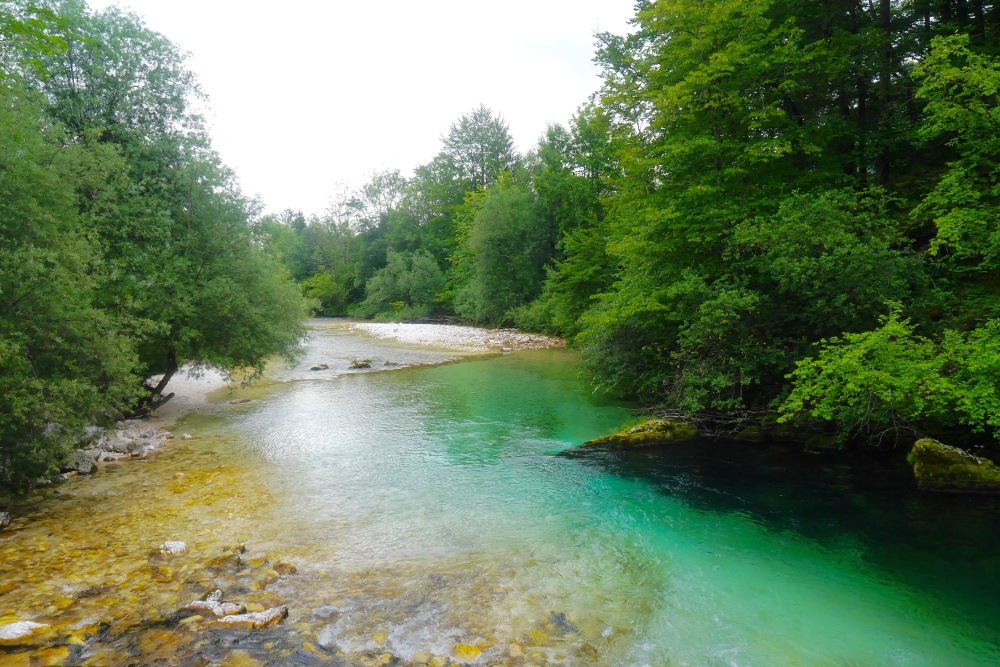
The Radovna River flows though the 1.6 kilometre-long Vintgar Gorge
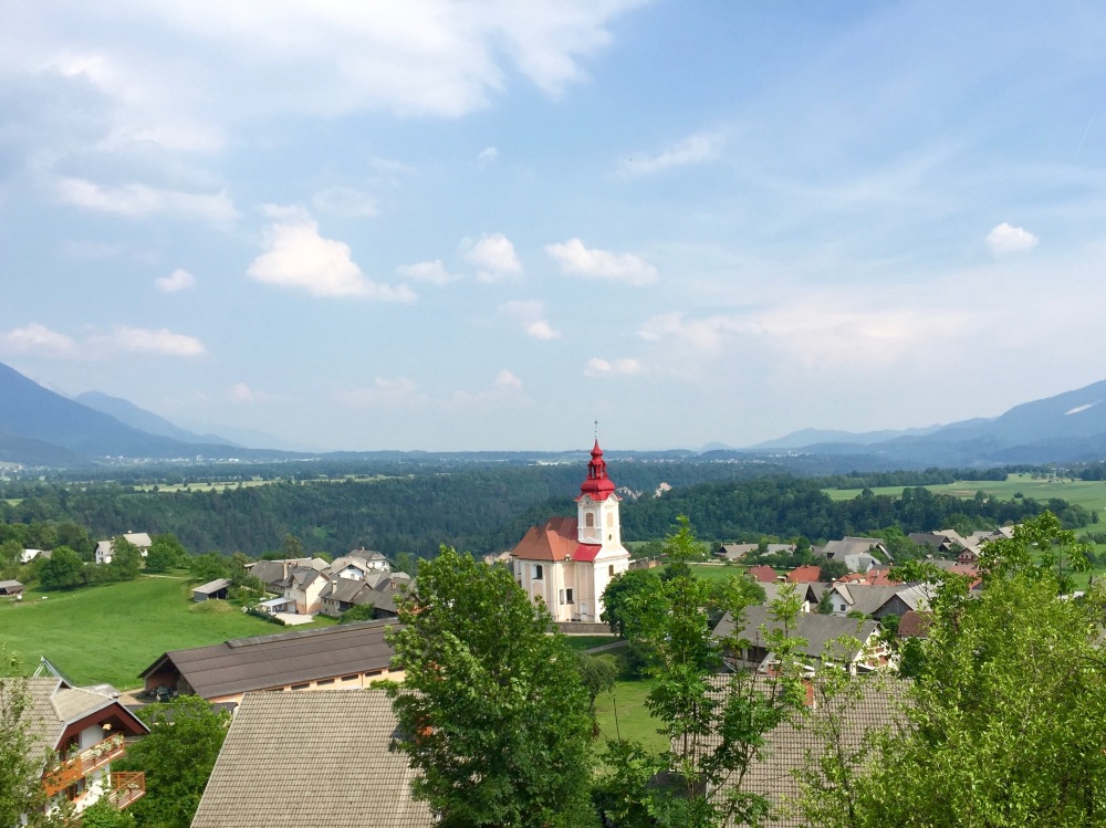
Zasip, one of several picturesque villages we walked though on our return to Bled from Vintgar Gorge
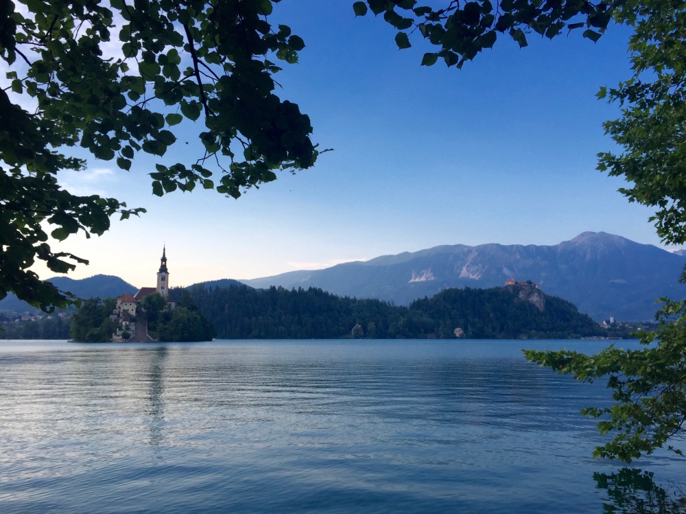
Bled Island, at the southern end of Lake Bled
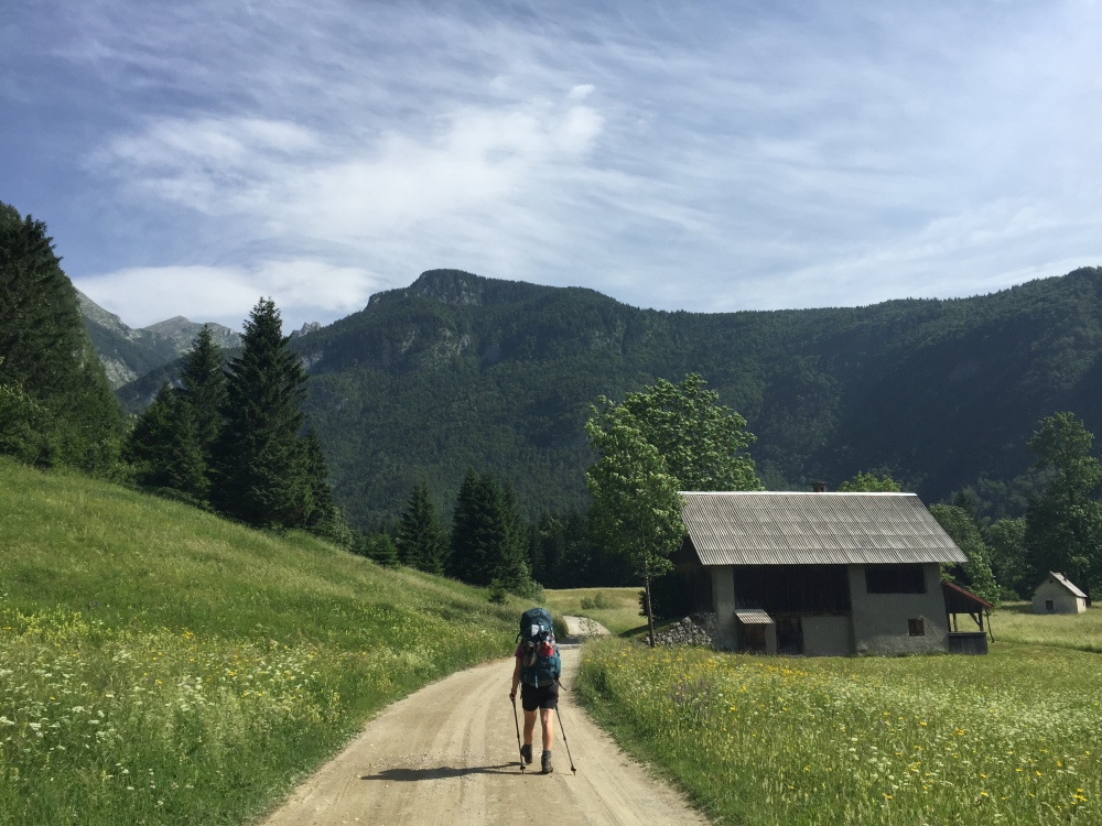
Our sightseeing continued into the late afternoon: by the time we walked back to town from the gorge, found somewhere to have dinner, topped up our food supplies at the local supermarket and returned to our guest house to pack (by taking the long way around the lake), the sun had long since disappeared. And we’d done our feet no favours; they were hot, swollen and sore. We finished packing just before midnight, and then we were up and getting ready to leave just five hours later. We jumped on a bus from Lake Bled and trundled through the countryside to the small, lakeside village of Ribcev Laz, our starting point for the hike.
The first hour of the hike led us through small rural villages and past fields. It wasn’t yet 9am but the heat was quickly intensifying and our packs were weighing heavily on our shoulders: nervous about the availability water in the limestone landscape, we were carrying almost five litres each. Which, on top of our usual gear, meant our packs weighed in excess of 20 kilograms.
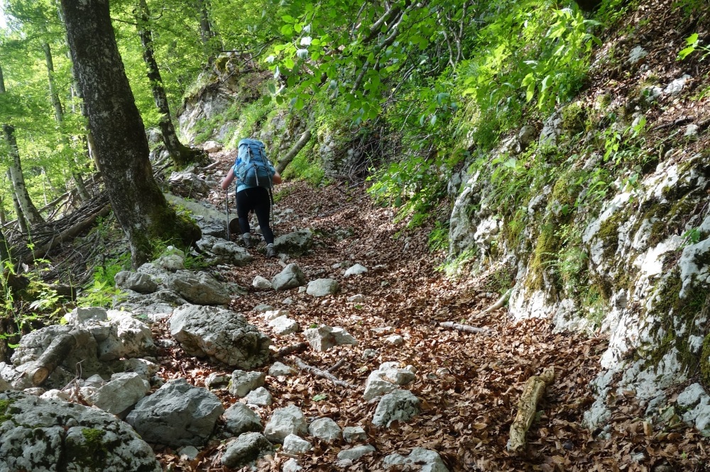
When we finally reached the forest within the national park, the cool shade offered by the trees was a welcome relief. The trail meandered up through the forest, alongside Mostnica Gorge, a deep chasm in the forest through which Mostnica River was thundering. We left the forest briefly to walk through more fields and past a small collection of huts and farmhouses. But the further we walked along this gradual gradient, the more apprehensive I grew, as we had hardly knocked off any of the 1900 metres we had yet to ascend before the day was over. The longer we reached the point to start climbing, the steeper that climb would be.
The emerald-coloured Monstnica River
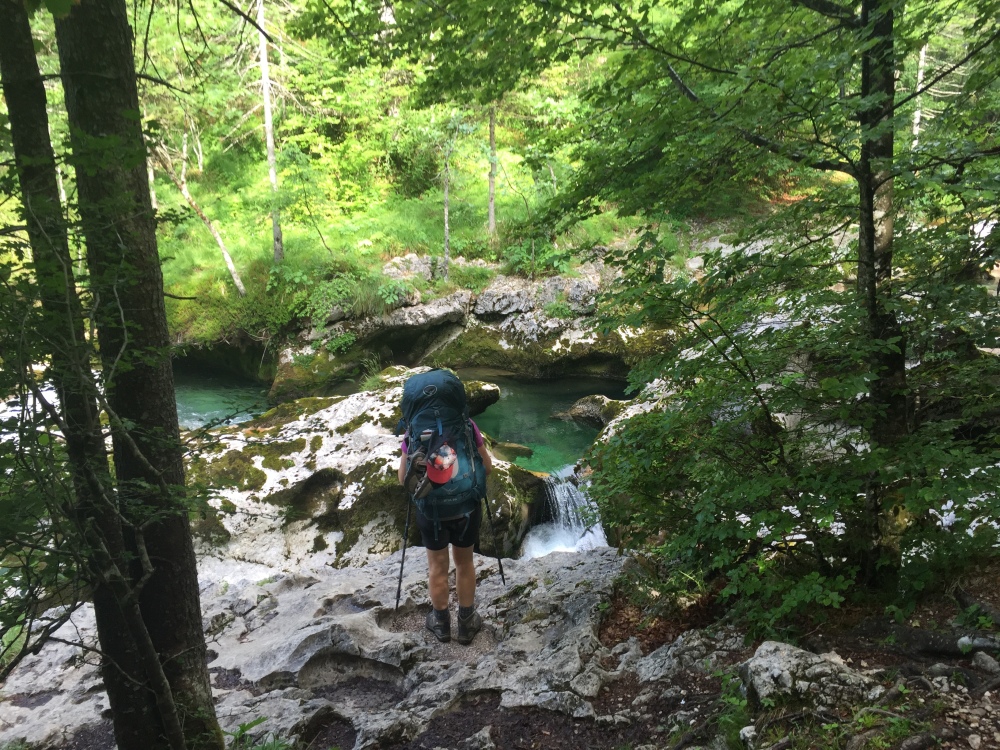
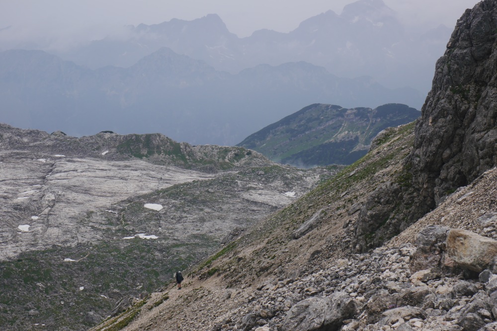
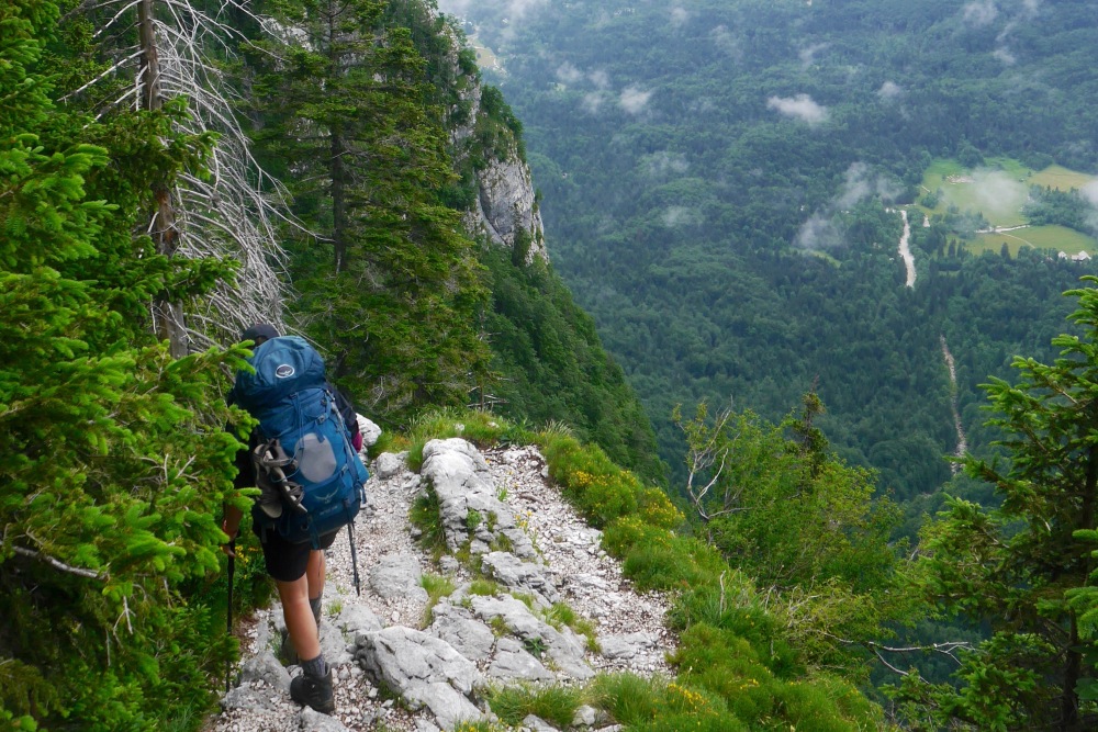
Enjoying some easy walking early in the hike
And then, without warning, the dreaded climb began. It was incredibly steep. In fact, I’ve never walked a section of trail so punishing, so arduous. For several hours we relentlessly climbed a series of switchbacks, each just as steep as the previous. By the time we emerged above the tree line, our legs were burning, our shoulders were aching, and the film of sweat enveloping my entire body was drying to a salty crust.
The struggle was real (photo credit E.M)
As we sidled around the western slope of Tosc, a 2275 metre-high peak, we soon reached Vodnikov Dom, a shingle-clad hut that sleeps 58 hikers when it opens for the summer season. For now, it was undergoing renovations, and three men (and a friendly dog) were hard at work hammering, painting and readying the hut for the influx of summer visitors.
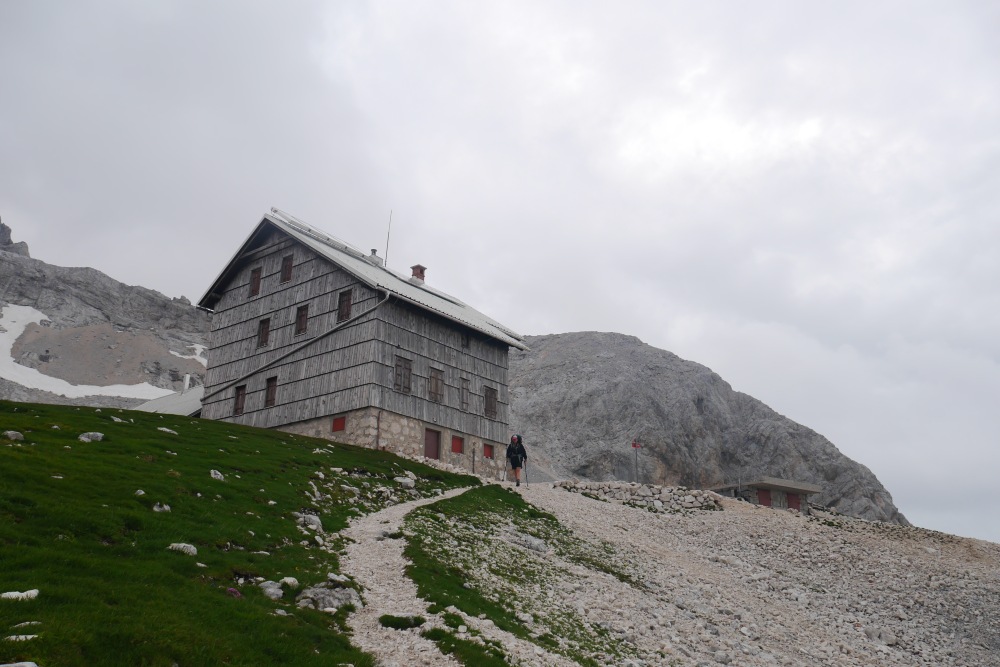
From Vodnikov Dom, we could see our intended destination: Dom Planika, the hut that at 2400 metres, is perched just below the summit of Triglav (we were planning to stealth-camp somewhere near the hut). Although the workmen said it was a mere two hour walk away, it looked impossibly high from where we were sitting. We had already been walking for seven hours, and four of those involved solid climbing. The weight of our packs and the mammoth effort required to get us this far had left us shattered.
The transverse across the western slope of Tosc
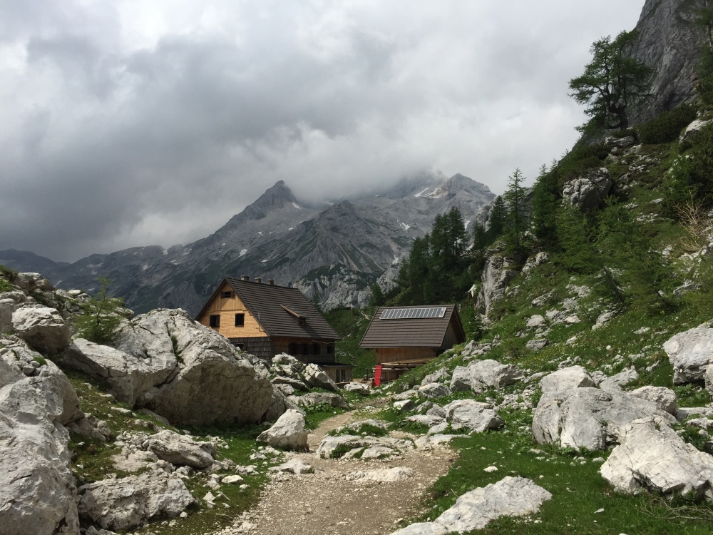
Vodnikov Dom
We consulted our map, considered the gathering clouds that were closing in on Triglav and sympathised with our aching bodies. And unaminously voted to descend to the grassy plateau below us. We reckoned we would be able to stealth-camp out of sight of Vodnikov Dom, rest our weary legs and start afresh early in the morning.
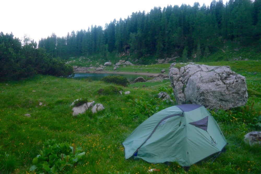
We set up camp amongst a collection of seemingly abandoned stone cottages and crumbling walls, amidst a minefield of marmot burrows. Soon we were stretched out amongst the wildflowers, a hot tea in one hand and Kindle in the other, although it was hard to concentrate on the page in front of us while such a stark yet spectacular landscape surrounded us. Having only encountered three other hikers (day-walkers) all day, it felt as if we could be the only people in the entire national park; a pretty special feeling.
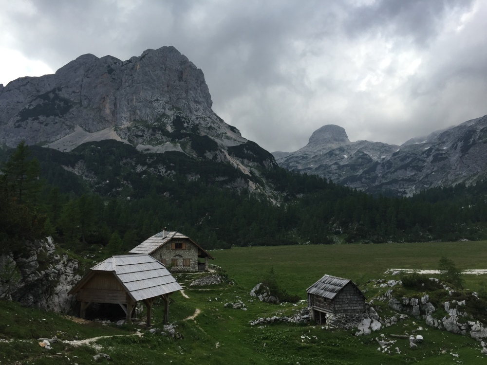
Huts and cottages surround the grassy plateau below Triglav
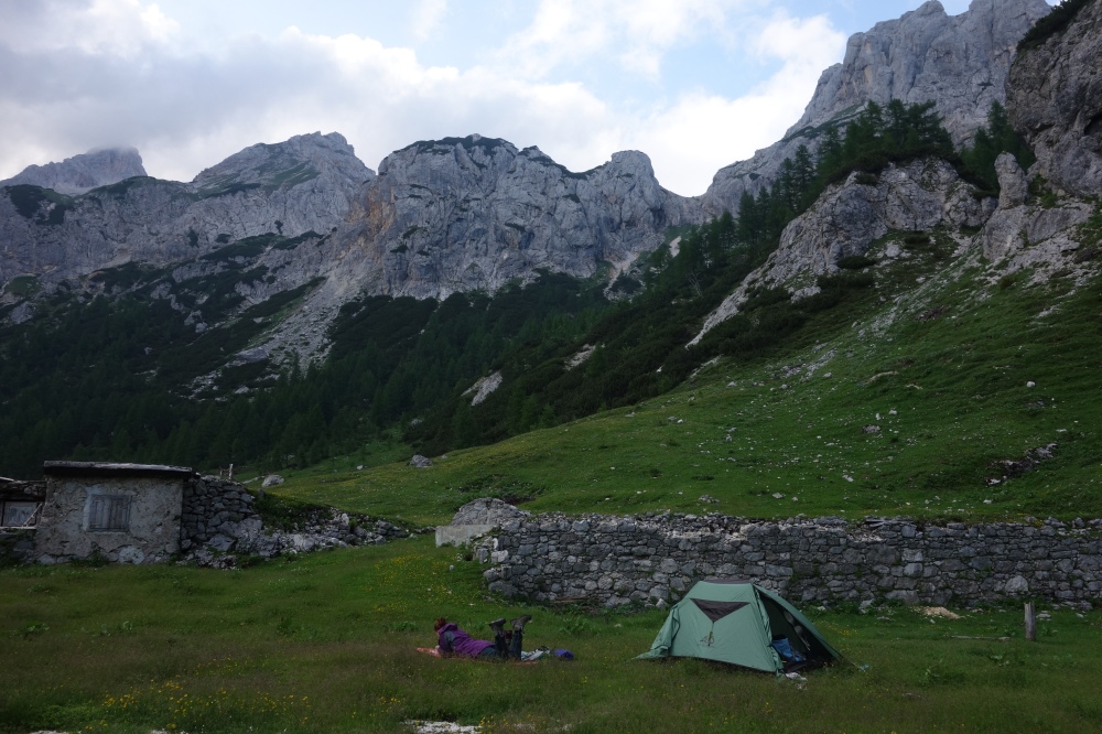
Savouring some downtime under Triglav
We were up and admiring the clear blue skies early the next morning, but the weather deteriorated by the time we made the ascent to Dom Planika two and a half hours later. The hut wouldn’t open to hikers for a few more days, so we tried to shelter from the gusty wind that had picked up as we ate morning tea against the hut wall, without much luck. We had hoped to climb Triglav, a three-hour return trip from the hut, however dark clouds were already obscuring the summit and rain threatened. Walking in the Alps offered the following advice regarding the summit climb: “The ascent to the summit of Triglav is continuously airy and exposed….don’t even contemplate the ascent in poor visibility and note that the limestone can be quite slippery when damp, with ice readily forming when temperates are low”.
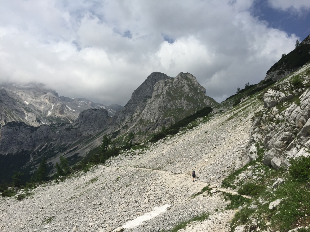
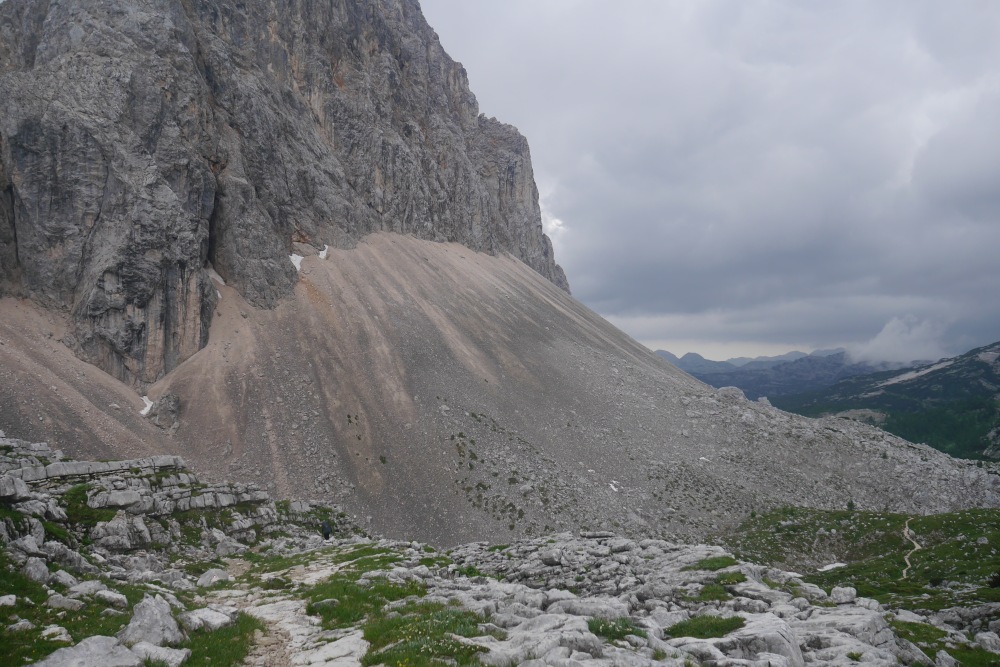
So, tragically, summiting our first Slovenian mountain would have to wait for another time. We piled on a few more layers of warm clothes and pressed on towards Koča pri Triglavskih jezerih hut, a further 10 kilometres from Dom Panika. The worsening weather and the precariousness of the track made for slow progress; in the freezing rain we scrambled across loose scree slopes, gingerly inched our way across steep patches of snow, and negotiated sections of crumbling track, clinging the mountainside by means of rusting steel cables bolted into the rock. At points along the trail the visibility dropped to just 20 metres or so; probably better to not be able to see the hundreds of metres we could fall if we placed a wrong foot in the snow.
Leaving Dom Planika and our chance to summit Triglav behind
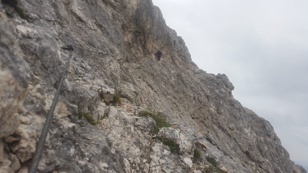
Aided by steel cables on precarious sections of track
Carefully crossing steep snow
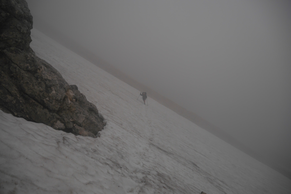
On the trail ahead, two hikers appear as specks on the snow
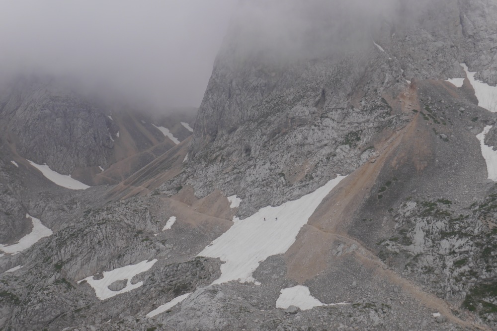
We didn’t stop again until after we had crossed Hribaricoe plateau, a barren and windswept limestone plateau, and descended out of the wind into the head of the Triglav Lakes Valley. The desolate limestone landscape before us was almost unworldly, it was unlike any place I’ve seen before.
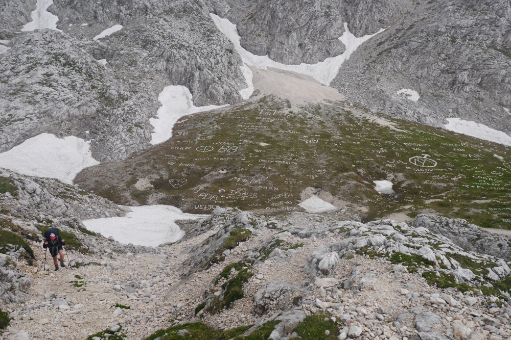
Past visitors leave their mark in stones
The limestone landscape at the head of the Triglav Lakes valley
The Julian Alps
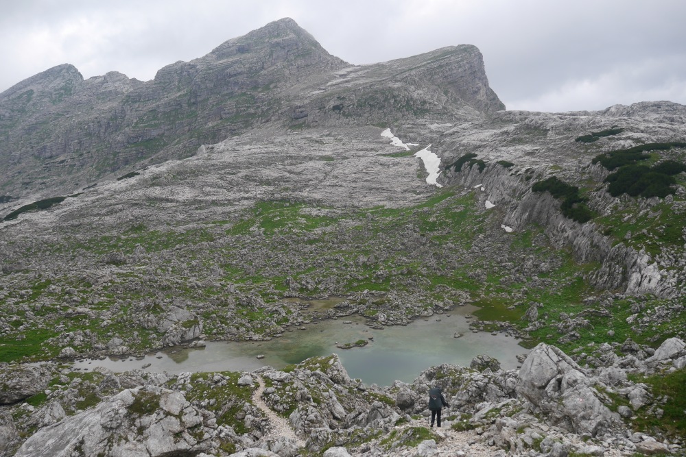
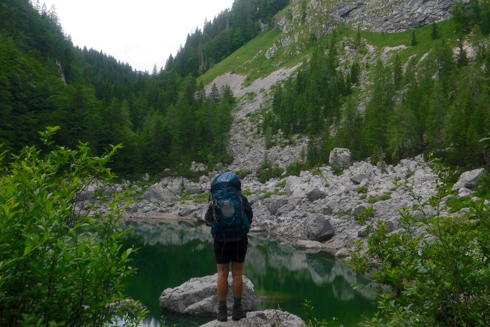
The rain continued as we passed Zelnarica, a 2320 metre peak emerging from a colossal scree slope that must have been hundreds of metres high. It was much easier walking from here; a gradual descent across the limestone folds, past deep aquamarine lakes and into the treeline. Once in the forest, we had to carefully dodge the abundance of black alpine salamanders (Salamanda atra atra) that were on the move in the still-falling rain.
Zelnarica towers above the head of the triglav Lakes valley
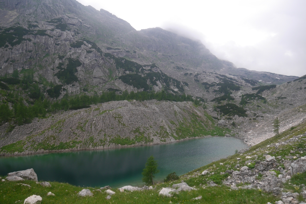
The aptly named Green Lake
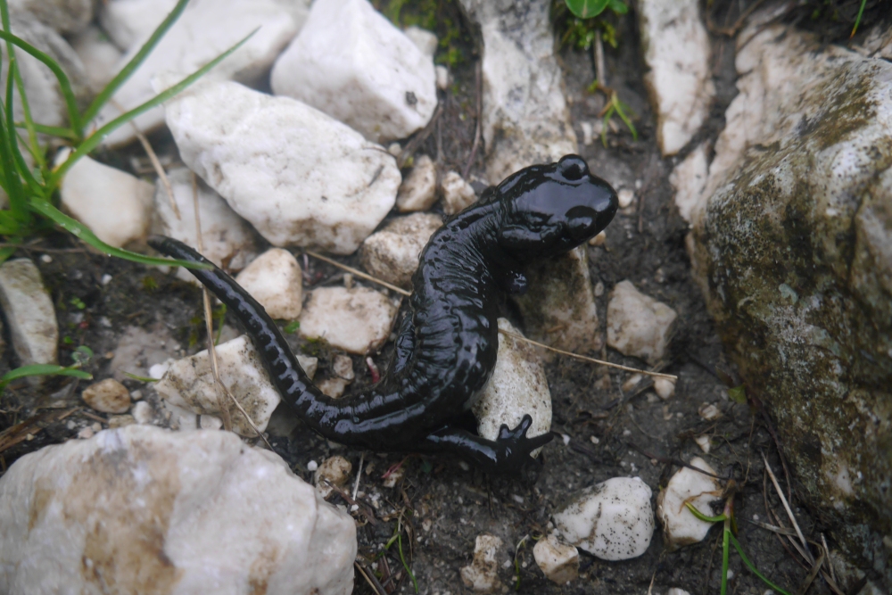
One of many alpine salamanders
We arrived at Koča pri Triglavskih jezerih hut, which sits on the shore of Dvojno jezero (Double Lake) at 7pm, after 10 cold and wet hours on our feet. It was a little tricky to find a stealth-camping spot out of sight of the hut, given the only flat ground was that immediately surrounding it, but we managed to summon the energy to set up our tent behind a large boulder (thankfully, during a brief respite from the rain). We wouldn’t have bothered with the stealth, given the late hour and our waning energy, except that this hut was actually open, meaning there were a few people about to potentially tell us to move on (for camping is not actually allowed in the national park). We peeled off our wet clothes, cooked up a quick dinner of noodles and tuna (it’s amazing what tastes positively gourmet in the face of ravenous hunger) brewed a hot tea, and crawled into our sleeping bags, completely exhausted.
Aforementioned boulder, with Double Lake in the background
It rained for most of the night, and we woke to an overcast sky the next day (and an infestation of slugs, the only inhabitants of the national park loving the wet weather). We packed up quickly and were on our way by 6.30am, after checking the weather forecast posted outside the hut. It wasn’t looking good, with the weather predicted to further deteriorate by the afternoon. Not keen on another day of hiking in the rain, we decided to deviate from the trail as described in Walking in the Alps, and take a shorter, albeit much steeper, trail down to the western side of Bohinjsko Jezero (Lake Bohinj). From there, if the weather did in fact worsen, we could jump on a bus back to Bled, rather than having to take the longer trail to the eastern (far) side of the lake.
The trail meandered through forest, passing Črno jezero (Black Lake), and just as suddenly as the climb was upon us on the first day, the descent began. We were to drop 700 metres in elevation in just over 700 metres of trail.
Black Lake (seems to be the same colour as Green Lake to me)
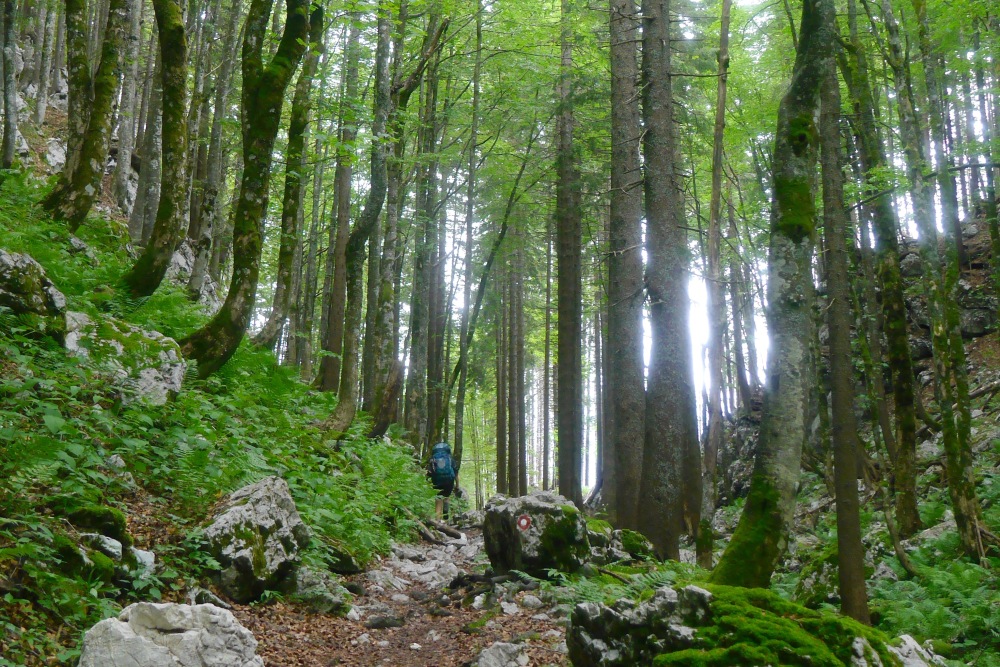
The trail passes through lush forest below Black Lake
It was a knee-jarring few hours, involving a narrow uneven track, perilous cabled sections and endless steep switchbacks, all the while trying not to plunge off the side of the mountain. At least we weren’t fighting gravity as hard as the dozen or so people we passed climbing up.
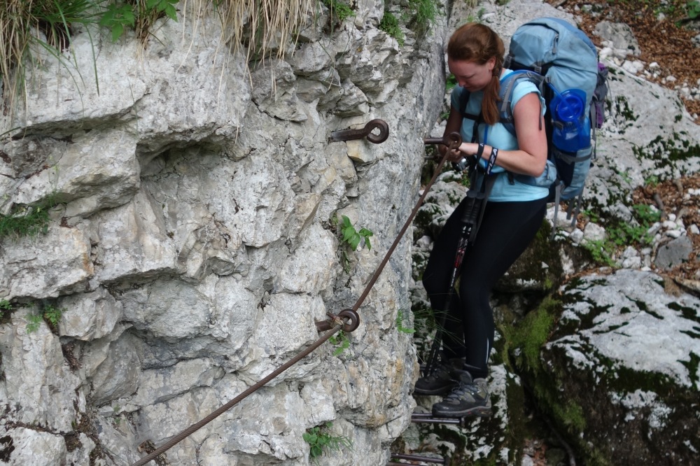
Negotiating a tricky section of cabled track
It’s a long way down to the valley floor
By the time we reached the bottom (not far from Koča pri Savic hut), our knees were buckling and our feet were burning. In the four (blissfully flat) kilometres it took to walk to the bus stop in Ukanc (opposite Zlaterog Holiday Park and campground), we passed quaint cottages with rambling gardens, fields of grazing cows, crossed clear turquoise rivers and ambled along the shores of Lake Bohinj.
The stunning Sava Bohinjka flows into Lake Bohinj
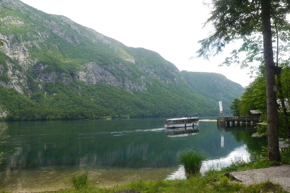
The still, clear waters of Lake Bohinj
We stumbled into the bus shelter just minutes before the heavens opened. It was a 45 minute wait until the next bus back to Bled and the pouring rain didn’t let up the entire time. Our bus shelter quickly filled with cyclists, day walkers and locals that had been caught out in the downpour. Only upon boarding the long-awaited bus, and finding ourselves in the first confined space in three days, did I appreciate the overwhelming stench of the “eau de hiker” we had been cultivating. I’d like to take this opportunity to apologise to our fellow passengers for the heady mix of sweat, dirt, spilt noodles, dampness, dried sweat, sunscreen and mud that we unleashed upon them.
A couple of hours later we found ourselves back at our lovely guesthouse by Lake Bled, following a cruel two kilometre walk from the bus stop. A long hot shower and a hearty pasta dinner and I was out for the count.
Exhaustion and poor weather aside, it had been a brilliant hike. What appealed to me may not appeal to everyone, for I am happiest when I am as far from signs of humanity as possible. I loved the novelty of the exotic landscape, the ruggedness of the limestone mountains, the sense of isolation within Triglav National Park, and the undeveloped nature of the Julian Alps.
Slovenia covers just over 20,000km², but half of that land consists of forest and woodland, spread across its predominently mountainous topography (the highest proportion of forest and woodland in any European country outside of Scandinavia). It’s the ideal destination for those seeking solitude, an escape from the crowds, but with all the convenience of having the rest of Europe on your doorstep. I wouldn’t hesitate to recommend Slovenia as a hiking destination to anyone, although its relative anonymity (for now) is one of Slovenia’s most appealing features for anyone looking to hike off the beaten track.

Beautiful journey! Thanks for sharing.
LikeLike